AP PGECET 2024 Geo Engineering and Geo Informatics Question Paper is available for download here. Sri Venkateswara University, Tirupati on behalf of APSCHE conducted AP PGECET 2024 Geo Engineering and Geo Informatics on May 29 in Shift 1 from 9 AM to 11 AM. AP PGECET Question Paper 2024 consists of 120 MCQ-based questions in total carrying 1 mark each to be attempted in the duration of 2 hours.
AP PGECET 2024 Geo Engineering and Geo Informatics Question Paper with Answer Key PDF
Question 1:
The electromagnetic spectrum is a vast range of _____ waves, categorized by their
- (A) \( Sound, amplitude \)
- (B) \( Light, frequency \)
- (C) \( Pressure, wavelength \)
- (D) \( Energy, colour \)
Question 2:
The system that uses the Sun as a source of electromagnetic energy and records the naturally radiated and reflected energy from the object is called
- (A) \( Geographical Information System \)
- (B) \( Global Positioning System \)
- (C) \( Passive Remote Sensing \)
- (D) \( Active Remote Sensing \)
Question 3:
Which vector data analysis tool combines geometries and attributes from different layers?
- (A) \( Overlay \)
- (B) \( Map manipulation \)
- (C) \( Buffer \)
- (D) \( Cartesian distance measurement \)
Question 4:
Minimum inclination provide in tilted photograph is
- (A) \( 33 degrees \)
- (B) \( 25 degrees \)
- (C) \( 13 degrees \)
- (D) \( 3 degrees \)
Question 5:
A satellite image with 6-bit radiometric resolution has _____ gray levels
- (A) \( 16 \)
- (B) \( 32 \)
- (C) \( 64 \)
- (D) \( 128 \)
Question 6:
Contrast enhancement is a type of which enhancement?
- (A) \( Spectral \)
- (B) \( Spatial \)
- (C) \( Radiometric \)
- (D) \( Temporal \)
Question 7:
Sandstone is an example of
- (A) \( Non-foliated rock \)
- (B) \( Sedimentary rock \)
- (C) \( Igneous rock \)
- (D) \( Metamorphic rock \)
Question 8:
For which of the following purposes can the Geographic Information System not be used?
- (A) \( Studying the relative motions of planets \)
- (B) \( Disaster and business continuity planning \)
- (C) \( Deforestation \)
- (D) \( Development of public infrastructure facilities \)
Question 9:
In active remote sensing of Earth objects from a satellite-borne sensor, the source of the energy used for sensing, lies at the
- (A) \( Satellite \)
- (B) \( Sun \)
- (C) \( Object being sensed on Earth \)
- (D) \( Ground station \)
Question 10:
In GIS, reclassification is performed to
- (A) \( Group ranges of values into a single value within a data layer \)
- (B) \( Segment a data layer into multiple data layers \)
- (C) \( Combine multiple data layers to a single data layer \)
- (D) \( Classify a data layer using many attributes \)
Question 11:
Which of the following statement is NOT true regarding relief displacement in vertical photographs in the context of aerial photogrammetry?
- (A) \( Relief displacement is the shift in the photographic position of an object caused by the elevation of the object (above or below the datum) \)
- (B) \( Relief displacement is always in non-radial direction from the principal point \)
- (C) \( Relief displacement can cause straight roads (not passing through the ground principal point) to appear crooked in undulating terrain \)
- (D) \( The magnitude of relief displacement is affected by the flying height of the camera (assuming everything else to be same) \)
Question 12:
A GIS analyst has two raster datasets with the same number of rows and columns. The analyst computes the average of the two input raster layers to generate a new raster layer with the same size as the input raster layers. What type of raster data analysis operation is performed?
- (A) \( Local \)
- (B) \( Neighborhood \)
- (C) \( Zonal \)
- (D) \( Global \)
Question 13:
The type of resolution of satellite images that signifies the degree of intensities of radiation the sensor is able to distinguish is
- (A) \( Spatial resolution \)
- (B) \( Spectral resolution \)
- (C) \( Radiometric resolution \)
- (D) \( Temporal resolution \)
Question 14:
Consider the following statements: Indian Remote Sensing (IRS-1A, 1B, 1C,1D) satellites are: I. Low orbiting satellites II. Geostationary satellites III. Meteorological satellites IV. Resource survey satellites Which of the above statements is/are correct
- (A) \( I and IV \)
- (B) \( II and III \)
- (C) \( I, II and IV \)
- (D) \( I, II, III and IV \)
Question 15:
Which among the following represent the curved surfaces
- (A) \( Overview \)
- (B) \( Bar scale \)
- (C) \( Map projection \)
- (D) \( North Arrow \)
Question 16:
Which of the following statement is TRUE?
- (A) \( Topography is not an example of continuous spatial feature \)
- (B) \( Geo-relational data model stores spatial data and attribute data separately \)
- (C) \( Object based data model stores spatial data and attribute data separately \)
- (D) \( Land surface temperature is an example of discrete spatial feature \)
Question 17:
Which one of the statements is NOT CORRECT for remote sensing?
- (A) \( It requires absorption of energy by the Earth's surface \)
- (B) \( It requires propagation of energy through atmosphere \)
- (C) \( It requires energy interaction with the Earth's surface features \)
- (D) \( It requires emission of electromagnetic radiation \)
Question 18:
Which of the following gases has the maximum percentage in the atmosphere?
- (A) \( Oxygen \)
- (B) \( Carbon \)
- (C) \( Nitrogen \)
- (D) \( Methane \)
Question 19:
De-stripping in radiometric correction is used to correct a type of
- (A) \( Sensor defect \)
- (B) \( Atmospheric effect \)
- (C) \( Path radiance \)
- (D) \( Geometric error \)
Question 20:
The Gondwana rock system is famous for which mineral?
- (A) \( Coal \)
- (B) \( Limestone \)
- (C) \( Copper \)
- (D) \( Diamond \)
Question 21:
In surveying, a contour may be defined as an imaginary line passing through
- (A) \( Points on the longitudinal section \)
- (B) \( Points of equal elevation \)
- (C) \( Points of local ground slope \)
- (D) \( Points of transverse section surveys \)
Question 22:
The main purpose of a 'Planimeter' is to measure
- (A) \( Volume \)
- (B) \( Area \)
- (C) \( Bearing \)
- (D) \( Elevation \)
Question 23:
Scale of a vertical aerial photograph of an undulating terrain is
- (A) \( Directly proportional to the height of terrain \)
- (B) \( Inversely proportional to the focal length of camera lens \)
- (C) \( Directly proportional to the flying height of aircraft \)
- (D) \( Uniform throughout the photograph \)
Question 24:
Which of the following is NOT a derivative of Digital Elevation Model (DEM)?
- (A) \( Slope \)
- (B) \( Aspect \)
- (C) \( Contour \)
- (D) \( Emissivity \)
Question 25:
What element makes up most of the Earth's core?
- (A) \( Silicon \)
- (B) \( Oxygen \)
- (C) \( Iron \)
- (D) \( Nickle \)
Question 26:
For minor adjustment of horizontal angles measured using a theodolite, the tangential screw is adjusted after
- (A) \( Both the planes are unclamped \)
- (B) \( The lower plate is clamped and the upper plate is unclamped \)
- (C) \( The upper plate is clamped and the lower plate is unclamped \)
- (D) \( Both the plates are clamped \)
Question 27:
Which of the following is a core vector GIS operation?
- (A) \( Overlaying \)
- (B) \( Ionosphere correction \)
- (C) \( Levelling \)
- (D) \( Multipath correction \)
Question 28:
Electromagnetic Spectrum can be broadly divided (in order of increasing wavelength)
- (A) \( X-rays, Gamma rays, Infrared, Ultraviolet, Visible, Radiowave, Microwave \)
- (B) \( Gamma rays, X-rays, Radiowave, Microwave, Ultraviolet, Infrared, Visible \)
- (C) \( X-rays, Gamma rays, Microwave, Radiowave, Ultraviolet, Infrared, Visible \)
- (D) \( Gamma rays, X-rays, Ultraviolet, Visible, Infrared, Microwave, Radiowave \)
Question 29:
Which of the following statement is INCORRECT?
- (A) \( Network analysis can be done with vector data \)
- (B) \( Linear features are clearly identified as discrete features in vector database \)
- (C) \( Satellite images are in vector format \)
- (D) \( Digital elevation model is in raster format \)
Question 30:
For a constant flying height, the average scale of an aerial photograph depends on which of the following parameter?
- (A) \( Focal length of the camera \)
- (B) \( Size of the photograph \)
- (C) \( Size of the objects in the area \)
- (D) \( Shape of the objects in the area \)
Question 31:
Which is a circular basin covering an area of 5.427 million square miles surrounded by North America and Eurasia?
- (A) \( Indian Ocean \)
- (B) \( Atlantic Ocean \)
- (C) \( Pacific Ocean \)
- (D) \( Arctic Ocean \)
Question 32:
In GIS, buffer is a zone with a specified width surrounding a spatial feature. Which of the following statements regarding buffer is CORRECT?
- (A) \( For a point feature, buffer is an ellipse with minor and major axes as buffer distances \)
- (B) \( For a polygon feature, buffer is a band with a specified distance created around the line conforming to the line's curve \)
- (C) \( Buffer zones are polylines \)
- (D) \( For a polygon feature, buffer is a belt of a specified distance from the edge of the polygon and conforming to its shape \)
Question 33:
Which of the following state is the largest producer of 'Brown Diamond' in India?
- (A) \( Punjab \)
- (B) \( Gujarat \)
- (C) \( Tamil Nadu \)
- (D) \( Maharashtra \)
Question 34:
Which scattering occurs when particles are very small compared to the wavelength of the radiation?
- (A) \( Mie \)
- (B) \( Nonselective \)
- (C) \( Rayleigh \)
- (D) \( Emitting \)
Question 35:
Which of the following statement about the TIN model is INCORRECT?
- (A) \( TIN contains irregularly spaced sampled points \)
- (B) \( Triangulation is performed to form network of triangles \)
- (C) \( In the TIN model, the edges represent features such as peaks and depression \)
- (D) \( In the TIN model, the edges form contiguous, non-overlapping triangular facets and can be used to capture the position of linear features \)
Question 36:
To visually distinguish between a river channel and a canal on an image, having similar widths and located in the same area, the most important parameter used is _____
- (A) \( Size \)
- (B) \( Shape \)
- (C) \( Tone \)
- (D) \( Texture \)
Question 37:
'Transit the telescope' of a theodolite involves
- (A) \( Rotating the theodolite about its vertical axis \)
- (B) \( Rotating the telescope about its trunnion axis \)
- (C) \( Rotating the telescope about its line of collimation \)
- (D) \( Rotating the theodolite by 90 degrees in horizontal plane \)
Question 38:
The survey carried out to delineate natural features, such as hills, rivers, forests and man-made feature such as towns, villages, buildings, roads, transmission lines and canals is classified as
- (A) \( Engineering survey \)
- (B) \( Geological survey \)
- (C) \( Land survey \)
- (D) \( Topographic survey \)
Question 39:
Which of the following is NOT a metamorphic rock?
- (A) \( Marble \)
- (B) \( Sandstone \)
- (C) \( Quartzite \)
- (D) \( Slate \)
Question 40:
A closed contour line with one or more higher contour lines inside represents
- (A) \( Cliff \)
- (B) \( Hill \)
- (C) \( Valley \)
- (D) \( Cave \)
Question 41:
The _____ is the extended margin of each continent occupied by relatively shallow seas and gulfs
- (A) \( Deep sea plan \)
- (B) \( Continental slope \)
- (C) \( Oceanic deeps \)
- (D) \( Continental shelf \)
Question 42:
Which of the following statement is INCORRECT in the context of GIS?
- (A) \( CLIP erases a part of one of the input layers \)
- (B) \( SPLIT overlays polygons and keeps all areas in both layers \)
- (C) \( INTERSECT overlays polygons and keeps only the common portions of both layers \)
- (D) \( UNION overlays polygons and keeps all areas in both layers \)
Question 43:
What provides orientation among the following
- (A) \( Key \)
- (B) \( Neatline \)
- (C) \( Title \)
- (D) \( Compass \)
Question 44:
Which of the following method is NOT used for compact storage of raster GIS data?
- (A) \( Chain code \)
- (B) \( Run-length code \)
- (C) \( Quadtree \)
- (D) \( Decision-tree \)
Question 45:
_____ is a raster image resampling technique that DOES NOT alter any of the output cell values from the input raster dataset
- (A) \( Nearest neighbor \)
- (B) \( Cubic convolution \)
- (C) \( Bilinear \)
- (D) \( Kriging \)
Question 46:
The maximum depth of Lithosphere is found in the
- (A) \( Pacific Ocean \)
- (B) \( Siberian Plain \)
- (C) \( Patagonian Desert \)
- (D) \( Himalayan Mountains \)
Question 47:
In India, the largest reserve of Bauxite is found in
- (A) \( Andhra Pradesh \)
- (B) \( Odisha \)
- (C) \( Jharkhand \)
- (D) \( Gujarat \)
Question 48:
Which of the following rocks may also contain fossils of plants, animals, and other microorganisms that once lived on them?
- (A) \( Sedimentary rocks \)
- (B) \( Extrusive igneous rocks \)
- (C) \( Metamorphic rocks \)
- (D) \( Plutonic rocks \)
Question 49:
What is meant by the term 'spatial filtering' in remote sensing?
- (A) \( Changing the position of pixels in an image because of inconsistencies in the relationship between sensor and surface during data collection \)
- (B) \( Making parts of the image at a different scale to another part of the image \)
- (C) \( Separating a scene into separate constituent parts and focusing on a smaller section to increase the resolution \)
- (D) \( Selectively preserving certain pixel frequencies in an image to enhance particular features or edges of objects \)
Question 50:
Which of the following statistical measures CANNOT be computed from the multispectral image histograms?
- (A) \( Mean, skewness, kurtosis \)
- (B) \( Covariance matrix \)
- (C) \( Co-occurrence matrix \)
- (D) \( Correlation matrix \)
Question 51:
Radiocarbon dating technique is used to estimate the age of
- (A) \( Rocks \)
- (B) \( Monuments \)
- (C) \( Soil \)
- (D) \( Fossils \)
Question 52:
Optimal flight planning for a photogrammetric survey should be carried out considering
- (A) \( Only side-lap \)
- (B) \( Only end-lap \)
- (C) \( Either side-lap or end-lap \)
- (D) \( Both side-lap as well as end-lap \)
Question 53:
What is used to translate map measurement?
- (A) \( Overview \)
- (B) \( Bar scale \)
- (C) \( Map projection \)
- (D) \( North Arrow \)
Question 54:
Which of these is NOT a division of the Ocean Floors?
- (A) \( The Deep-Sea Plain \)
- (B) \( The Continental Deeps \)
- (C) \( The Continental Shelf \)
- (D) \( The Continental Slope \)
Question 55:
The plan of a map was photo copied to a reduced size such that a line originally 100 mm, measures 90 mm. The original scale of the plan was 1:1000. The approximate revised scale is
- (A) \( 1:900 \)
- (B) \( 1:1111 \)
- (C) \( 1:1121 \)
- (D) \( 1:1221 \)
Question 56:
Select the example of active sensor in remote sensing, from the following sensors
- (A) \( Laser scanner \)
- (B) \( Return beam vidicon \)
- (C) \( Television camera \)
- (D) \( Electro-optical scanner \)
Question 57:
What causes the changes in seasons?
- (A) \( Earth's rotation and revolution \)
- (B) \( Earth's revolution \)
- (C) \( Earth's revolution and inclination of its axis \)
- (D) \( Earth's rotation and inclination of its axis \)
Question 58:
The interaction of the electromagnetic radiation produced by an instrument with a specific wavelength to illuminate a target on the terrain for studying its scattered radiance is called:
- (A) \( Passive remote sensing \)
- (B) \( Active remote sensing \)
- (C) \( Global positioning system \)
- (D) \( Neutral remote sensing \)
Question 59:
The phenomenon 'crab and drift' is associated with which method of survey
- (A) \( Triangulation \)
- (B) \( Astronomical survey \)
- (C) \( Aerial photogrammetry \)
- (D) \( Tacheometric survey \)
Question 60:
Which of the following statements about Principal Component Analysis (PCA) is CORRECT?
- (A) \( A two-dimensional data set can have up to four principal components \)
- (B) \( The first principal component accounts for the majority of conceivable data variation \)
- (C) \( The second principal component attempts to encapsulate the mode of the data \)
- (D) \( The transformed principal components are non-linear combinations of the original variables \)
Question 61:
In a transit theodolite, the accidental error due to eccentricity of verniers is primarily counteracted by
- (A) \( Reading both the verniers \)
- (B) \( Reading different parts of main scale \)
- (C) \( Reading right and left faces \)
- (D) \( Taking both right swing readings \)
Question 62:
Which rocks are formed from solidification and cooling of magma?
- (A) \( Igneous rocks \)
- (B) \( Metamorphic rocks \)
- (C) \( Sedimentary rocks \)
- (D) \( Chemical sedimentary rocks \)
Question 63:
In the context of satellite image classification, which of the following statement is CORRECT?
- (A) \( Both ANN and Fuzzy C-means clustering are parametric classifiers \)
- (B) \( Both ANN and Fuzzy C-means clustering are non-parametric classifiers \)
- (C) \( ANN cannot be both supervised and unsupervised classification method \)
- (D) \( Fuzzy C-means clustering is a supervised classification method \)
Question 64:
For an overhanging cliff contour lines are
- (A) \( Different elevations unite to form one line \)
- (B) \( Different elevations cross one another \)
- (C) \( Closely spaced \)
- (D) \( Closed lines with higher values inside them \)
Question 65:
The ratio between the reflected to the incident energy on a surface at a particular wavelength gives the _____ of the surface
- (A) \( Spectral reflectance \)
- (B) \( Spectral transmittance \)
- (C) \( Spectral radiance \)
- (D) \( Spectral irradiance \)
Question 66:
\textbf>The histogram equalization applied to a digital image generally DOES NOT yield a truly uniform histogram of the transformed image due to
- (A) \( Discrete nature of pixel values \)
- (B) \( Poor contrast of the original image \)
- (C) \( Low frequency image information \)
- (D) \( Presence of edges \)
Question 67:
It is easy to integrate GIS, Remote Sensing, and GPS technologies because these are
- (A) \( Digital, analogue, and generic \)
- (B) \( Digital, analogue, and manual \)
- (C) \( Digital, spatial, and generic \)
- (D) \( Negative, positive, and neutral \)
Question 68:
Which of the following rivers does not belong to North America?
- (A) \( Missouri \)
- (B) \( Amazon \)
- (C) \( St. Lawrence \)
- (D) \( Ohio \)
Question 69:
What are the three type groups of vector data?
- (A) \( Points, lines, and imagery \)
- (B) \( Points, lines, and polygons \)
- (C) \( Points, polygons, and imagery \)
- (D) \( Points, lines, polygons, and imagery \)
Question 70:
Small scale representation of map is known as
- (A) \( Attribute map \)
- (B) \( Plan \)
- (C) \( Grid \)
- (D) \( Non-spatial map \)
Question 71:
Part of the solar radiation incident on the water surface gets refracted as per
- (A) \( Rayleigh's law \)
- (B) \( Snell's law \)
- (C) \( Moore's law \)
- (D) \( Newton's law \)
Question 72:
What are the three types of models we can create when generating a schema?
- (A) \( Physical, logical, or rational \)
- (B) \( Logical, rational, or metadata \)
- (C) \( Physical, logical, or metadata \)
- (D) \( Physical, rational, or metadata \)
Question 73:
Remote Sensing is unique because it provides:
- (A) \( Synoptic view \)
- (B) \( Special information \)
- (C) \( Superior information \)
- (D) \( Encrypted information \)
Question 74:
'Iso-centre' is the point
- (A) \( In which the tilted axis of the camera meets the vertical photograph \)
- (B) \( In which the bisector of the angle of tilt meets the vertical photograph \)
- (C) \( In air space, the location of the optical centre of the lens of the camera at the time of exposure \)
- (D) \( Where the perpendicular from the nodal point meets the photograph \)
Question 75:
What are mathematical models that translate between coordinate systems?
- (A) \( Evolutions \)
- (B) \( Translations \)
- (C) \( Declinations \)
- (D) \( Transformations \)
Question 76:
What is the purpose of topology in GIS?
- (A) \( To represent the spatial relationships between geographic features \)
- (B) \( To store tabular data \)
- (C) \( To display imagery \)
- (D) \( To conduct statistical analysis \)
Question 77:
In a Landsat-8 scene, digital number (DN) values of a pixel in band-4, band-5 and band-10 are 80, 100 and 30, respectively. What would be the NDVI value for the same pixel (round off to 3 decimal places)?
- (A) \( 0.111 \)
- (B) \( 0.222 \)
- (C) \( 0.556 \)
- (D) \( 0.889 \)
% Solution \textbf{Solution:} The Normalized Difference Vegetation Index (NDVI) is calculated using the near-infrared (NIR) and red bands of a satellite image. For Landsat-8, band-5 is the NIR band, and band-4 is the red band. Band-10 is a thermal infrared band and is not used in the NDVI calculation. The formula for NDVI is: \(\)NDVI = \frac{NIR - Red}{NIR + Red}\(\) Given values: NIR (Band-5) = 100 Red (Band-4) = 80 Plugging these values into the formula: \(\)NDVI = \frac{100 - 80}{100 + 80} = \frac{20}{180} = \frac{1}{9}\(\) Converting this fraction to a decimal and rounding to three decimal places: \(\)NDVI = 0.111111... \approx 0.111\(\)
View Solution
Question 78:
Which item does the "Export Data" window not ask us to provide in GIS software?
- (A) \( Format \)
- (B) \( Output location \)
- (C) \( Features to export \)
- (D) \( Coordinate system \)
Question 79:
Which of the following is an area of Remote Sensing application?
- (A) \( Dispatch of emergency medical services \)
- (B) \( Egg Production \)
- (C) \( Mapping and water resources \)
- (D) \( Census calculation \)
Question 80:
Hyperspectral sensor consists of
- (A) \( Large number of wide and discrete bands \)
- (B) \( Small number of wide and contiguous bands \)
- (C) \( Large number of narrow and contiguous bands \)
- (D) \( Small number of narrow and discrete bands \)
Question 81:
Which of the following head digitizing provides good quality and is commonly used?
- (A) \( Heads up \)
- (B) \( Heads down \)
- (C) \( Head lateral \)
- (D) \( Head horizontal \)
Question 82:
In aerial vertical photography, the longitudinal overlap is normally kept as
- (A) \( 50 % \)
- (B) \( 60 % \)
- (C) \( 70 % \)
- (D) \( 80 % \)
Question 83:
GIS deals with which kind of data
- (A) \( Numeric data \)
- (B) \( Binary data \)
- (C) \( Spatial data \)
- (D) \( Complex data \)
Question 84:
Choose the CORRECT statement regarding microwave remote sensing
- (A) \( Spatial resolution of passive microwave remote sensor is coarser than that of active microwave remote sensor from the same platform \)
- (B) \( The intensity of signal returned by an object does not depends on its geometric as well as dielectric properties \)
- (C) \( It is possible to "see through" the dense forest canopy using X-band active microwave remote sensing (i.e., signals can penetrate the dense forest canopy) \)
- (D) \( Microwave remote sensing cannot be used in soil moisture studies \)
Question 85:
Which of the following is a coarse grained igneous rock that contains quartz and feldspar?
- (A) \( Granite \)
- (B) \( Marble \)
- (C) \( Andesite \)
- (D) \( Basalt \)
Question 86:
What is the hardest mineral?
- (A) \( Diamond \)
- (B) \( Feldspar \)
- (C) \( Tale \)
- (D) \( Quartz \)
Question 87:
Consider the following statements:
I. In aerial photogrammetry the 'filter' is placed in front of the lens to:
II. Reduce the effect of atmospheric haze.
III. Protect the lens from dust.
IV. Provide uniform light distribution over the format.
Which of the above statements is/are correct
- (A) \( I and II only \)
- (B) \( II only \)
- (C) \( I and III only \)
- (D) \( I, II and III \)
Question 88:
A zone of a specified width around a point, line or polygon is known in GIS as
- (A) \( Polygon overlay \)
- (B) \( Buffering \)
- (C) \( Dissolving \)
- (D) \( Clipping \)
Question 89:
Choose the CORRECT statement in case of visual image interpretation.
- (A) \( Tone/Color is a primary element while Size, Shape and Texture are secondary elements \)
- (B) \( Size, Shape and Texture are primary elements while Tone/Color is a secondary element \)
- (C) \( Tone/Color is a primary element while Pattern and Association are secondary elements \)
- (D) \( Association refers to the frequency of tonal changes in an area of image \)
Question 90:
Resampling of a raster image in remote sensing:
- (A) \( Increases the accuracy \)
- (B) \( Increases the precision \)
- (C) \( Decreases data details \)
- (D) \( Increases data details \)
Question 91:
A line lying throughout the surface of the ground and preserving a constant inclination to the horizontal is
- (A) \( Contour gradient \)
- (B) \( Horizontal equivalent \)
- (C) \( Contour interval \)
- (D) \( Vertical control \)
Question 92:
By 'spatial data' we mean data that has
- (A) \( Complex values \)
- (B) \( Geographic location values \)
- (C) \( Graphic values \)
- (D) \( Decimal values \)
Question 93:
Spectral signature of an object in a satellite image does NOT depend on the
- (A) \( Season of the year \)
- (B) \( Wavelength of electromagnetic spectrum \)
- (C) \( Swath width of the satellite \)
- (D) \( Reflectance value from the object \)
Question 94:
Which of the following band is better for delineating water bodies?
- (A) \( Blue band \)
- (B) \( Red band \)
- (C) \( Green band \)
- (D) \( Near-infrared band \)
Question 95:
A 1:50,000 scale map can be compared to the following spatial resolution:
- (A) \( 50000 \, m \)
- (B) \( 50 \, m \)
- (C) \( 1/50000 \, m \)
- (D) \( Not possible to compare \)
Question 96:
What is it called when a mineral easily splits along a flat surface?
- (A) \( Streak \)
- (B) \( Cleavage \)
- (C) \( Luster \)
- (D) \( Color \)
Question 97:
Who coined the term 'Remote sensing'?
- (A) \( Evelyn L. Pruitt, a geographer \)
- (B) \( Gaspard Felix Tournachon, a French scientist \)
- (C) \( Wilbur Wright, an Italian scientist \)
- (D) \( Albert Einstein \)
Question 98:
TIN stands for
- (A) \( Traffic Internet Network \)
- (B) \( Triangulated Irregular Network \)
- (C) \( Temporal Interest Network \)
- (D) \( Temperature Interface Node \)
Question 99:
If the image formed by the objective lens is not in the same plane with cross hairs, then it is known as
- (A) \( Focusing of eye piece \)
- (B) \( Focusing of objective \)
- (C) \( Parallax \)
- (D) \( Aberration \)
Question 100:
Interpolation is made possible by a principle called
- (A) \( Spatial Autocorrelation \)
- (B) \( Spatial Auto-correction \)
- (C) \( Thematic Autocorrelation \)
- (D) \( Thematic auto-correction \)
Question 101:
Water bodies appear in dark tone in Near Infrared (NIR) image, because water _____ most of the NIR radiations incident on it.
- (A) \( Absorbs \)
- (B) \( Emits \)
- (C) \( Reflects \)
- (D) \( Scatters \)
Question 102:
In GIS, which tables give data unique characteristics?
- (A) \( Data \)
- (B) \( Excel \)
- (C) \( Raster \)
- (D) \( Attribute \)
Question 103:
The part radiation due to scattered diffused radiation entering the field of view of a remote sensor other than that from the required target
- (A) \( Increases the contrast of the image but reduces the sharpness \)
- (B) \( Reduces the contrast of the image and also its sharpness \)
- (C) \( Increases both the contrast and sharpness \)
- (D) \( Reduces the contrast but increases the sharpness \)
Question 104:
Which type of geodatabase can have multiple editors but only if they work on different parts of the data?
- (A) \( File geodatabase \)
- (B) \( Personal geodatabase \)
- (C) \( Microsoft database \)
- (D) \( Enterprise database \)
Question 105:
Thermal Infrared images are provided by
- (A) \( LANDSAT MSS and IRS LISS-II sensors \)
- (B) \( SPOT and CARTOSAT \)
- (C) \( IKONOS and QUICKBIRD \)
- (D) \( LANDSAT TM and NOAA AVHRR sensors \)
Question 106:
The ratio of the total solar radiant energy return by a planetary body to the total radiant energy incident on the body, is called
- (A) \( Reflectance factor \)
- (B) \( Albedo \)
- (C) \( Diffraction \)
- (D) \( Refraction \)
Question 107:
What will be the value of absorbance, if the absorbed and incident energies are given as 67 J and 109 J respectively?
- (A) \( 0.16 \)
- (B) \( 0.69 \)
- (C) \( 0.61 \)
- (D) \( 0.72 \)
Question 108:
Energy flux may affect which of the following?
- (A) \( Lens \)
- (B) \( Strength of the signal \)
- (C) \( Aperture \)
- (D) \( Declination \)
Question 109:
The rank of the matrix \(A = \begin{bmatrix} 1 & 2 & 3
1 & 4 & 2
2 & 6 & 5 \end{bmatrix}\) is
- (A) \( 1 \)
- (B) \( 3 \)
- (C) \( 2 \)
- (D) \( 0 \)
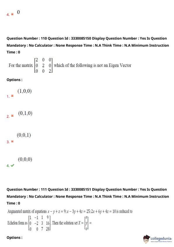
Question 110:
For the matrix \(\begin{bmatrix} 2 & 0 & 0
0 & 2 & 0
0 & 0 & 2 \end{bmatrix}\) which of the following is not an Eigen Vector
- (A) \( (1,0,0) \)
- (B) \( (0,1,0) \)
- (C) \( (0,0,1) \)
- (D) \( (0,0,0) \)
Question 111:
Augmented matrix of equations \(x - y + z = 9; 2x - 3y + 4z = 25; 2x + 6y + 4z = 10\) is reduced to Echelon form as \(\begin{bmatrix} 1 & -1 & 1 & 9
0 & -2 & 3 & 16
0 & 0 & 7 & 28 \end{bmatrix}\). Then the solution set \(X = \begin{bmatrix} x
y
z \end{bmatrix}\) is
- (A) \( \begin{bmatrix} 3
-2
4 \end{bmatrix} \)
- (B) \( \begin{bmatrix} -4
2
3 \end{bmatrix} \)
- (C) \( \begin{bmatrix} 3
4
-2 \end{bmatrix} \)
- (D) \( \begin{bmatrix} -2
3
4 \end{bmatrix} \)
Question 112:
\(\lim_{x \to \infty} x \tan \left( \frac{1}{x} \right) = \) _____
- (A) \( 0 \)
- (B) \( 1 \)
- (C) \( 2 \)
- (D) \( 3 \)
Question 113:
\(\int_{-\pi/6}^{\pi/6} \frac{(\sin x)^5 (\cos x)^3}{x^4} dx =\)
- (A) \( \pi/2 \)
- (B) \( \pi/4 \)
- (C) \( \pi/8 \)
- (D) \( 0 \)
Question 114:
Evaluate \(\oint_C (y^2 dx - x^3 dy)\), where \(C\) is the positively oriented circle of radius 2 centered at origin.
- (A) \( 24\pi \)
- (B) \( 4\pi \)
- (C) \( -24\pi \)
- (D) \( -4\pi \)
Question 115:
\(f(x) = 2x^2 - 2x + 6\) will have a minimum value at \(x=\) _____
- (A) \( 0.2 \)
- (B) \( 0.3 \)
- (C) \( 0.4 \)
- (D) \( 0.5 \)
Question 116:
If \(f(x)\) is differentiable function in x then it is
- (A) \( Unbounded \)
- (B) \( Many Valued \)
- (C) \( Continuous \)
- (D) \( Bounded \)
Question 117:
As per Green's theorem \(\oint_C Mdx + Ndy = \iint_R (\_\_\_\_\_)dxdy\)
- (A) \( \frac{\partial M}{\partial x} - \frac{\partial N}{\partial y} \)
- (B) \( \frac{\partial N}{\partial y} - \frac{\partial M}{\partial x} \)
- (C) \( \frac{\partial N}{\partial x} - \frac{\partial M}{\partial y} \)
- (D) \( \frac{\partial M}{\partial y} - \frac{\partial N}{\partial x} \)
Question 118:
Probability Density function \(f(x)\) of a continuous random variable is given by \(f(x) = ce^{-|x|}, -\infty < x < \infty\). If the total probability \(\int_{-\infty}^{\infty} f(x) dx = 1\) then \(c =\)
- (A) \( 0.6 \)
- (B) \( 0.5 \)
- (C) \( 0.4 \)
- (D) \( 0.3 \)
Question 119:
A problem of statistics is given to three students A, B and C whose chances of solving are \(\frac{1}{2}, \frac{1}{3}\) and \(\frac{1}{4}\) respectively. What is the probability that the problem will be solved?
- (A) \( 25/32 \)
- (B) \( 23/32 \)
- (C) \( 21/32 \)
- (D) \( 29/32 \)
Question 120:
The probability that at least one of the events A and B occurs is 0.6. If A and B occur simultaneously with the probability 0.2 then \(P(A) + P(B) = \)?
- (A) \( 0.4 \)
- (B) \( 1.2 \)
- (C) \( 0.8 \)
- (D) \( 1.4 \)


Comments