


CBSE Class 12 Geography Question Paper 2024 PDF (Set 2 - 64/5/2) is available for download here. CBSE conducted the Geography exam on February 29, 2024 from 10:30 AM to 1:30 PM. The total marks for the theory paper are 70. The question paper will contain 20% MCQ-based questions, 40% competency-based questions, and 40% short and long answer type questions.
CBSE Class 12 Geography Question Paper 2024 (Set 2 - 64/5/2) with Answer Key
| CBSE Class 12 2024 Geography Question Paper with Answer Key | Check Solution |
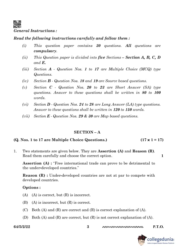
Two statements are given below. They are Assertion (A) and Reason (R).
Read them carefully and choose the correct option.
Assertion (A): "Free international trade can prove to be detrimental to the under-developed countries."
Reason (R): Under-developed countries are not at par to compete with developed countries.
View Solution
Free international trade often leads to economic challenges for under-developed countries, as they lack the industrial infrastructure and competitiveness to match developed economies. This can result in economic dependency and exploitation. The reason correctly explains the assertion. Under-developed countries, due to limited resources and technological advancements, may find themselves unable to compete with stronger economies, leading to a cycle of economic subjugation. These challenges can hinder their growth and prevent them from realizing the benefits of open international trade.
Quick Tip: Developing economies often struggle to compete in free trade due to weaker industries and financial constraints. These countries need targeted support and infrastructure development to compete effectively.
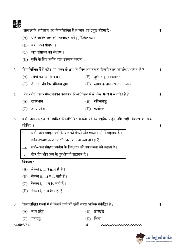
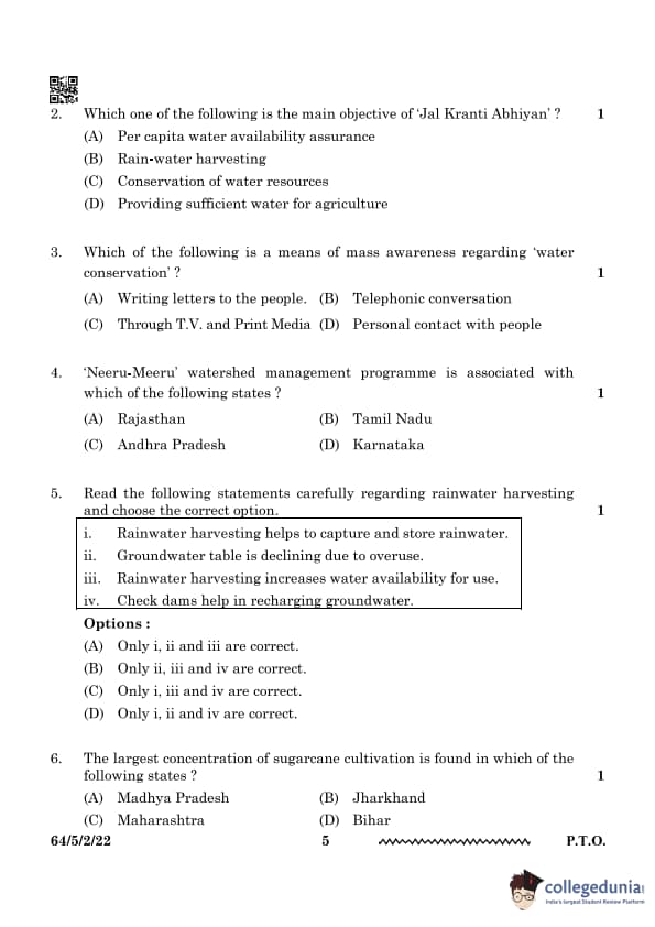
Which one of the following is the main objective of 'Jal Kranti Abhiyan'?
View Solution
The main objective of the 'Jal Kranti Abhiyan' is to ensure the per capita water availability by managing water resources efficiently. This initiative focuses on improving the water supply and ensuring that each individual has access to an adequate amount of water. The program aims to promote sustainable water usage and distribution.
Quick Tip: Remember, while various water conservation initiatives exist, 'Jal Kranti Abhiyan' primarily focuses on ensuring that water availability is sufficient for every citizen by focusing on efficient resource management, rather than just conservation or agriculture-specific needs.
Which of the following is a means of mass awareness regarding 'water conservation'?
View Solution
T.V. and print media are effective tools for mass awareness about water conservation. These platforms reach a large audience, spreading crucial information on sustainable water usage and conservation efforts. Media plays a pivotal role in informing the public about water scarcity issues, guiding individuals, communities, and governments to take necessary actions to conserve water resources. With the widespread penetration of these media, campaigns can highlight practical methods for saving water in daily life, as well as raise awareness about larger initiatives that impact water conservation on a regional or national scale.
Quick Tip: Media campaigns play a key role in educating people about the importance of water conservation. Awareness through these channels can inspire collective efforts for sustainable water management.
'Neeru-Meeru' watershed management programme is associated with which of the following states?
View Solution
The 'Neeru-Meeru' programme was launched in Andhra Pradesh to address water conservation and watershed management. It focuses on rainwater harvesting, afforestation, and sustainable use of water resources. The programme encourages local communities to actively participate in the preservation and efficient use of water, aiming to increase the state's water table levels and ensure water availability during dry seasons. Through this initiative, villagers are trained to manage water systems and adopt environmentally sustainable practices that reduce water wastage.
Quick Tip: 'Neeru-Meeru' means "Water and You" and aims at improving water availability in Andhra Pradesh. The initiative emphasizes community participation and sustainable water use practices.
Read the following statements carefully regarding rainwater harvesting and choose the correct option.
i. Rainwater harvesting helps to capture and store rainwater.
ii. Groundwater table is declining due to overuse.
iii. Rainwater harvesting increases water availability for use.
iv. Check dams help in recharging groundwater.
View Solution
The correct statements are:
1. Rainwater harvesting indeed helps to capture and store rainwater, reducing dependence on surface water sources.
2. Rainwater harvesting increases water availability for use by recharging the groundwater and making water more accessible for both agricultural and domestic uses.
3. Check dams play a key role in recharging groundwater by storing rainwater and allowing it to percolate into the earth.
However, the statement regarding the groundwater table declining due to overuse (ii) is not a direct effect of rainwater harvesting but rather a consequence of excessive water extraction without replenishment. Thus, the correct answer is Option (C).
Quick Tip: Rainwater harvesting and check dams play a crucial role in improving water availability and recharging groundwater, especially in regions facing water scarcity.
The largest concentration of sugarcane cultivation is found in which of the following states?
View Solution
Maharashtra is the state with the largest concentration of sugarcane cultivation in India. It has favorable climatic conditions, an extensive irrigation network, and a well-developed sugar industry. The state's sugarcane production is crucial for the economy, providing raw materials to many sugar mills. Other states like Uttar Pradesh and Karnataka also contribute significantly to sugarcane production, but Maharashtra remains the leader in this regard.
Quick Tip: Maharashtra’s dominance in sugarcane cultivation is supported by its favorable agronomic conditions, including irrigation facilities, and a strong industrial base.
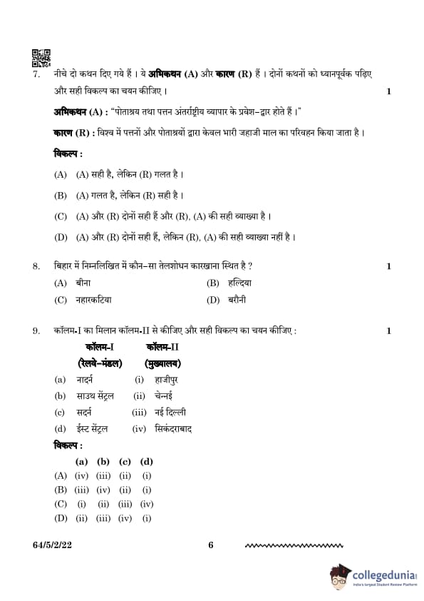
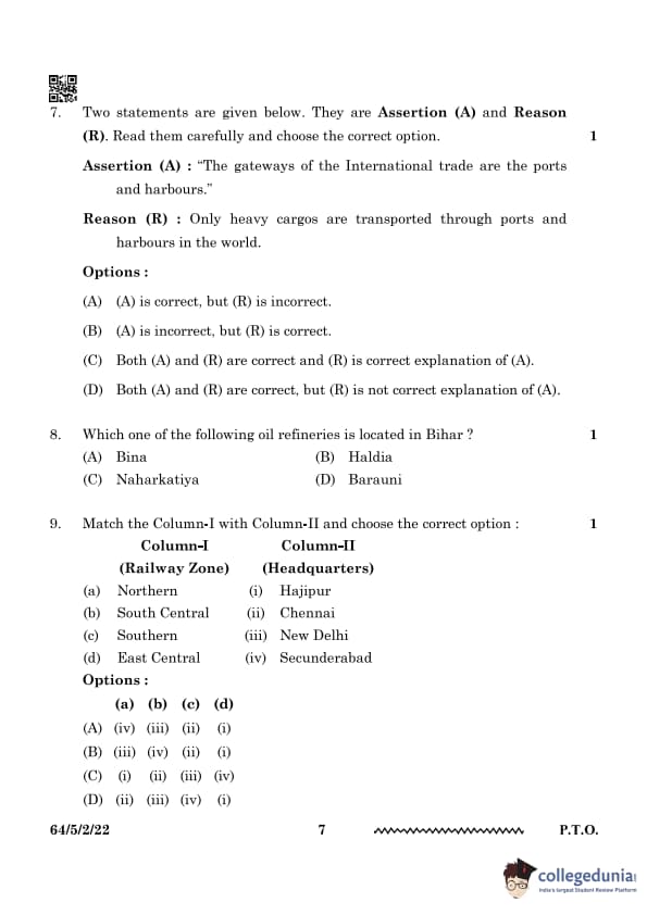
Two statements are given below. They are Assertion (A) and Reason (R). Read them carefully and choose the correct option.
Assertion (A): "The gateways of International trade are the ports and harbours."
Reason (R): Only heavy cargos are transported through ports and harbours in the world.
View Solution
Ports and harbours serve as gateways for international trade by facilitating the movement of goods and passengers. However, they are not limited to only heavy cargo; they also handle a variety of goods, including containers and perishables. Ports play a critical role in the global supply chain by acting as hubs for the import and export of goods, thereby supporting the economy and trade networks. Their infrastructure is essential for the smooth movement of various types of cargo, from bulk commodities to high-value, time-sensitive products.
Quick Tip: Ports play a crucial role in global trade by managing exports and imports efficiently. They are vital for the transport of goods across international waters, ensuring economic connectivity.
Which one of the following oil refineries is located in Bihar?
View Solution
The Barauni refinery is located in the Begusarai district of Bihar. It is one of the major refineries in India and plays a crucial role in the petroleum industry of the region. It was established in 1964 and has significantly contributed to the industrial development of Bihar and surrounding areas. Barauni refinery processes crude oil into various petroleum products, including gasoline, diesel, and kerosene.
Quick Tip: The Barauni refinery is key for the supply of petroleum products in Bihar and surrounding areas. It is a vital part of India's refining infrastructure.
Match the Column-I with Column-II and choose the correct option:
| Column-I (Railway Zone) | Column-II (Headquarters) |
|---|---|
| (a) Northern | (i) Hajipur |
| (b) South Central | (ii) Chennai |
| (c) Southern | (iii) New Delhi |
| (d) East Central | (iv) Secunderabad |
View Solution
The headquarters for Northern Railway is in New Delhi, South Central Railway in Secunderabad, Southern Railway in Chennai, and East Central Railway in Hajipur. These regional headquarters serve as the administrative and operational centers for the respective railway zones, facilitating efficient management of train services, infrastructure development, and maintenance across vast areas. Each railway zone in India has a designated headquarters to streamline operations and ensure smooth functioning.
Quick Tip: Indian Railways has 18 zones, with each having a designated headquarters. These zonal headquarters help in decentralizing the management of the extensive railway network in India.
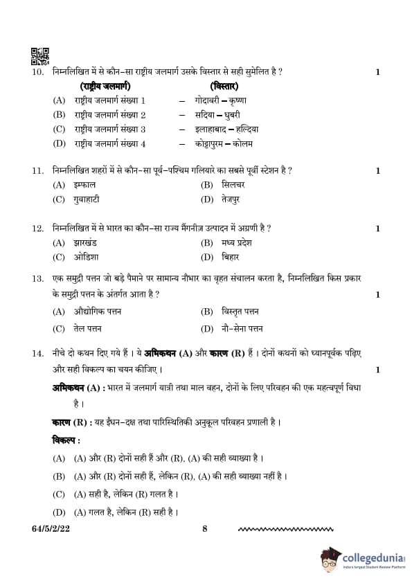
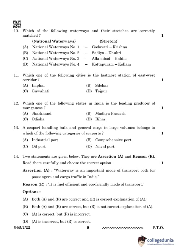
Which of the following waterways and their stretches are correctly matched?
View Solution
The Sadiya-Dhubri stretch of the Brahmaputra River is designated as National Waterway No. 2, promoting inland water transport. This waterway is an essential part of India's transport infrastructure, enabling the movement of goods and passengers along the river. The development of National Waterway No. 2 is expected to reduce transportation costs, alleviate road congestion, and contribute to economic growth in the northeastern region of India.
Quick Tip: Waterways play a crucial role in cargo transportation and economic development. Efficient water transport can enhance regional connectivity and reduce the environmental impact of land-based transportation.
Which one of the following cities is the lastmost station of the east-west corridor?
View Solution
Silchar is the last station of the East-West Corridor, which is a major transportation network in India connecting key eastern and western regions. Silchar, located in Assam, plays a pivotal role in the movement of goods and people between these regions.
Quick Tip: The East-West Corridor is a vital infrastructure project, linking key cities across India for better trade, communication, and travel.
Which one of the following states in India is the leading producer of manganese?
View Solution
Odisha is the leading producer of manganese in India. The state has rich mineral resources, particularly in the Keonjhar and Sundergarh districts, where large-scale manganese mining is conducted. Odisha’s manganese production is crucial for steel-making industries both within India and globally.
Quick Tip: Manganese is a key raw material in the steel-making process, and Odisha’s mineral wealth plays a significant role in India’s industrial growth.
A seaport handling bulk and general cargo in large volumes belongs to which of the following categories of seaports?
View Solution
Comprehensive ports handle a wide range of cargo, including bulk goods, general cargo, containers, and sometimes even oil. These ports are equipped to manage large volumes of diverse shipments, making them essential for global trade and transportation. They serve as major hubs for various industries and contribute to economic growth.
Quick Tip: Comprehensive ports are capable of handling different types of cargo, including bulk and general goods, and are vital for international trade.
Two statements are given below. They are Assertion (A) and Reason (R). Read them carefully and choose the correct option.
Assertion (A): "Waterway is an important mode of transport both for passengers and cargo traffic in India."
Reason (R): "It is a fuel-efficient and eco-friendly mode of transport."
View Solution
Waterways are an essential mode of transport in India due to their cost-effectiveness, fuel efficiency, and minimal environmental impact. With a network of rivers and canals, waterways provide an alternative to road and rail transport, particularly for bulky cargo. They contribute to the reduction of transportation costs and are a sustainable option for long-distance movement of goods. India's national waterways, including the Ganga, Brahmaputra, and others, are integral to the nation's transportation infrastructure.
Quick Tip: India has multiple national waterways that support cargo and passenger movement. These waterways play a vital role in boosting trade and regional connectivity.
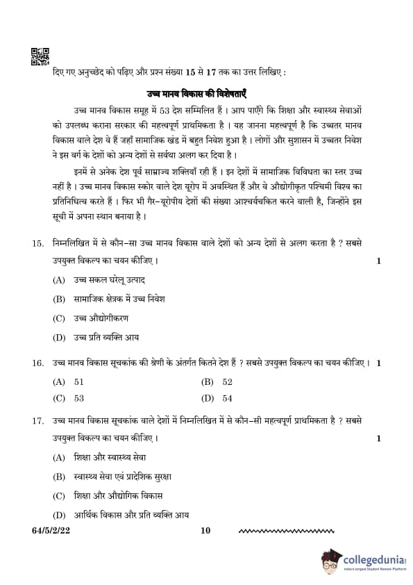
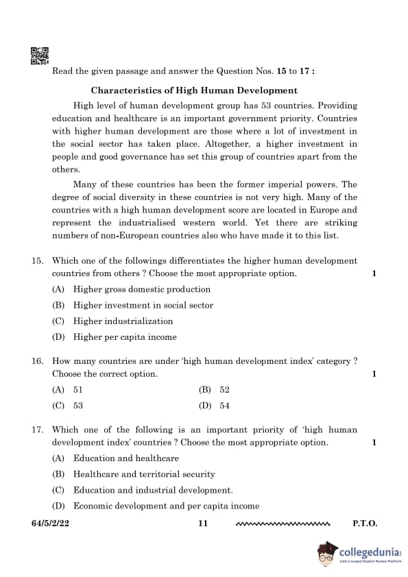
Which one of the following differentiates the higher human development countries from others? Choose the most appropriate option.
View Solution
Higher human development countries focus more on investment in the social sector, such as education, healthcare, and public services, rather than just economic indicators like GDP. These countries recognize that human development goes beyond monetary measures and includes aspects like health, education, and social well-being. By prioritizing these areas, they improve the overall quality of life, leading to sustainable progress and a more equitable society. This holistic approach results in better human development indices, such as life expectancy, literacy rates, and social equality.
Quick Tip: Investment in the social sector leads to improved quality of life and better human development indices. Sustainable development focuses on people, not just economic growth.
How many countries are under the ‘high human development index’ category? Choose the correct option.
View Solution
The number of countries categorized under the ‘high human development index’ are 53. The classification is based on factors such as life expectancy, education, and income levels. These factors are assessed to determine the quality of life and the overall well-being of a population. A high HDI score signifies that a country is investing in its human capital, which leads to improved living standards, economic progress, and social development.
Quick Tip: Countries with high HDI scores focus on sustainable development and human well-being. Investments in education, health, and income equity contribute to long-term prosperity.
Which one of the following is an important priority of 'high human development index' countries? Choose the most appropriate option.
View Solution
Countries with high human development prioritize investment in education and healthcare, which leads to better living standards and economic progress. By ensuring access to quality education and healthcare, these countries improve their workforce productivity, reduce poverty, and enhance overall well-being. This focus on human capital development fosters sustainable economic growth and helps address social inequalities.
Quick Tip: Education and healthcare are fundamental for long-term human development. Investments in these sectors create a strong foundation for economic and social advancement.
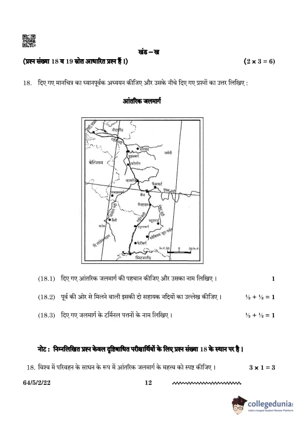
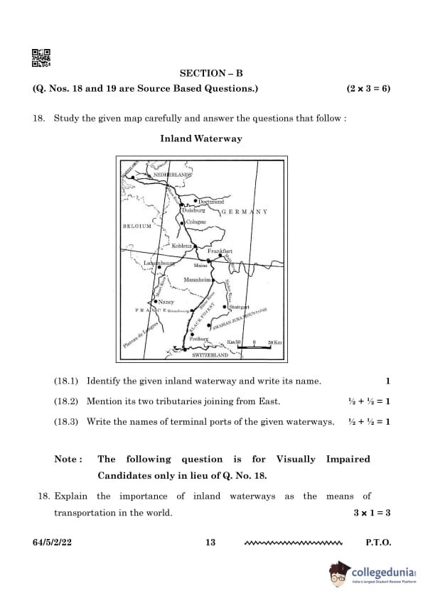
Identify the given inland waterway and write its name.

View Solution
The given inland waterway is the Rhine Waterway. It is one of the busiest and most important inland waterways in Europe, connecting Switzerland, Germany, France, and the Netherlands. The waterway plays a crucial role in facilitating trade and transportation within Europe, serving as a major route for the movement of goods like coal, chemicals, and agricultural products. It connects inland European regions to the North Sea, enabling easy access to global markets.
Quick Tip: The Rhine Waterway is crucial for transporting goods between inland Europe and the North Sea. Its strategic location makes it a vital transport route for economic activities in the region.
Mention its two tributaries joining from the East.
View Solution
The two tributaries of the Rhine River joining from the East are:
1. Main River
2. Neckar River
These tributaries contribute to the flow and navigability of the Rhine, enhancing its capacity to transport goods and supporting the river's role in regional trade. The Main and Neckar rivers are important water routes in their own right, but together with the Rhine, they form a major transport corridor in Central Europe.
Quick Tip: Tributaries play a vital role in enhancing the navigability and water volume of major rivers. They also contribute to the ecological health of the main river by supplying water and nutrients.
Write the names of terminal ports of the given waterways.
View Solution
The terminal ports of the Rhine Waterway are:
1. Rotterdam (Netherlands)
2. Basel (Switzerland)
These ports mark the northern and southern ends of the Rhine Waterway, connecting the river to major international trade routes. Rotterdam, in particular, is one of the largest seaports in the world and plays a critical role in European and global trade. Basel serves as an important inland port, linking the Rhine to the rest of Switzerland and surrounding regions.
Quick Tip: Rotterdam is one of the largest seaports in the world and a major gateway for European trade. It serves as a vital connection between the Rhine Waterway and international maritime shipping.
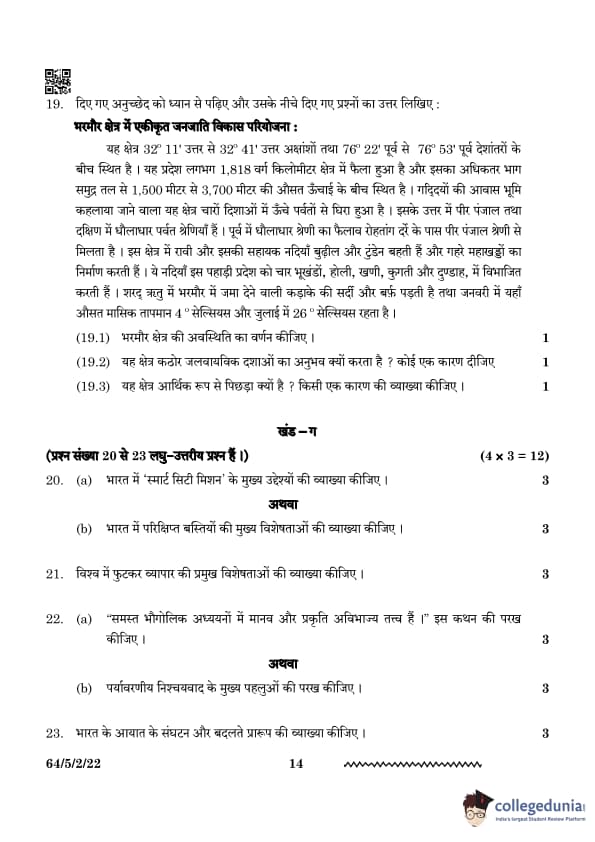
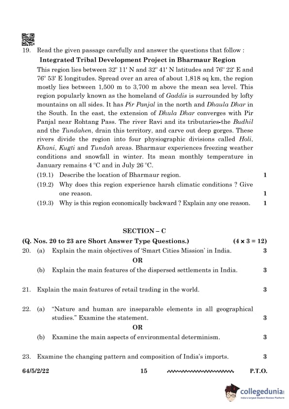
Describe the location of the Bharmour region.
View Solution
The Bharmour region is located in the state of Himachal Pradesh, India. It lies between latitudes 32° 11' N and 32° 41' N and longitudes 76° 22' E and 76° 53' E. The area is spread across 1,818 sq km, with an elevation ranging from 1,500 m to 3,700 m above sea level. Bharmour is a region of scenic beauty, surrounded by high mountains and valleys, and serves as an important cultural hub, especially known for its historical significance and religious importance.
Quick Tip: Bharmour is known as the homeland of Gaddis, a pastoral community. The Gaddis have a unique culture, and their traditional way of life is closely tied to the region's geography and climate.
Why does this region experience harsh climatic conditions? Give one reason.
View Solution
Bharmour experiences harsh climatic conditions due to its high altitude and mountainous terrain. The region is surrounded by the Pir Panjal and Dhauladhar ranges, leading to heavy snowfall in winters and freezing temperatures. The combination of elevation and geographic location contributes to a cold climate, with temperatures often dropping below freezing during winter. These extreme conditions create challenges for the local population and influence the flora and fauna of the region.
Quick Tip: Higher altitudes experience lower temperatures due to decreased atmospheric pressure. This phenomenon is due to the thinning of the atmosphere as altitude increases, which leads to lower temperatures.
Why is this region economically backward? Explain any one reason.
View Solution
The economic backwardness of Bharmour is primarily due to its difficult terrain and inaccessibility. The mountainous topography and lack of infrastructure hinder transportation and industrial development. These factors make it challenging for industries to thrive in the region, leading to limited economic opportunities. The lack of connectivity also restricts access to markets, further impacting the region’s economic growth.
Quick Tip: Remote hilly regions often face economic challenges due to limited connectivity and resources. Developing infrastructure and improving transportation links can help overcome these challenges.
Explain the main objectives of ‘Smart Cities Mission’ in India.
View Solution
The Smart Cities Mission in India seeks to transform urban infrastructure, enhance sustainability, and provide improved living conditions through the use of smart technologies. Its primary objectives include fostering efficient urban mobility, ensuring robust IT connectivity, promoting better governance, managing waste intelligently, and offering sustainable energy solutions. The mission places a strong emphasis on citizen participation and collaboration between the public and private sectors to accelerate development. Cities such as Pune, Bhopal, and Bhubaneswar have experienced notable advancements under this initiative.
Quick Tip: Smart Cities leverage digital technologies and data-driven strategies for enhanced urban management and efficiency.
Explain the main features of the dispersed settlements in India.
View Solution
Dispersed settlements in India are distinguished by houses that are spread out over a large area, typically in hilly, forested, or arid regions. These types of settlements are commonly found in states such as Himachal Pradesh, Arunachal Pradesh, and parts of Madhya Pradesh. They arise due to geographical challenges, limited availability of agricultural land, and traditional ways of living. The people living in these settlements typically engage in shifting cultivation, pastoralism, and small-scale farming.
Quick Tip: Dispersed settlements usually form in regions with challenging terrain and limited access, often due to the necessity of adapting to local environmental conditions.
Explain the main features of retail trading in the world.
View Solution
Retail trading involves the sale of goods and services directly to consumers. The main features of retail trading are:
Direct Sale to Consumers: Retail trading is characterized by the direct sale of goods and services to the end consumer.
Fixed Establishments or Stores: Most retail trading occurs in fixed locations, such as shops and malls, where consumers can visit and make purchases.
Street Peddling and Other Forms: Retail trade is also conducted through informal channels like street peddling, handcarts, and door-to-door selling.
Non-store Retail Trading: Retailers use alternative methods, including mail orders, telephone sales, automatic vending machines, and internet-based retail, to reach consumers without physical stores. Quick Tip: Retail trading is a dynamic sector, adapting to technological advances such as e-commerce, which offers convenience and broader reach to consumers.
“Nature and human are inseparable elements in all geographical studies.” Examine the statement.
View Solution
Nature and humans share a reciprocal relationship in geographical studies. Human activities are shaped by natural conditions like climate, terrain, and resources, while human interventions modify natural landscapes. Geography studies this interaction to understand spatial patterns of development and environmental changes. For example, fertile plains support agriculture, while mountainous areas limit settlement. Sustainable development depends on balancing human needs with environmental conservation. This interaction is essential in shaping the ways societies grow and interact with their environment.
Quick Tip: Human geography and physical geography together help in planning sustainable development. By understanding both natural systems and human impacts, better planning can ensure long-term environmental and societal well-being.
Examine the main aspects of environmental determinism.
View Solution
Environmental determinism suggests that human activities and cultural development are influenced by environmental factors like climate, landforms, and natural resources. It argues that people in temperate regions develop more advanced societies due to favorable climatic conditions, while harsh environments limit progress. This theory, however, has been criticized for being too simplistic, as human innovations and technology also shape development. The theory has been replaced by more nuanced perspectives that recognize the interaction between environmental conditions and human choices.
Quick Tip: Modern geography recognizes the role of both environment and human agency in shaping civilizations. Human creativity, technology, and culture also play significant roles in overcoming environmental challenges.
Examine the changing pattern and composition of India’s imports.
View Solution
India's imports have changed significantly over the decades. The main characteristics of the changing pattern and composition of India's imports are:
1950s and 1960s: During these decades, India primarily imported food grains, capital goods, machinery, and equipment to support its industrialization and economic development.
Balance of Payments: Despite efforts at import substitution, India faced an adverse balance of payments, as imports continued to exceed exports.
Post-1970s: After the 1970s, India saw a reduction in food grain imports, but the import of petroleum increased significantly, driven by the oil crises.
Current Composition: Today, India's import basket mainly consists of special steel, edible oil, chemicals, machinery, and electronics. Quick Tip: The composition of imports is a reflection of a country’s industrial development, energy needs, and agricultural productivity. A shift in imports often signifies changes in the economy's structure and global trends.
Examine any five factors affecting the density of population in the world.
View Solution
The density of population in a region is influenced by several factors. Five key factors affecting population density are:
Industrialization: Areas with high levels of industrialization tend to have higher population densities as they offer numerous employment opportunities that attract people from rural or less-developed areas.
Urbanization: Cities and urban areas provide better amenities, job opportunities, and infrastructure, leading to higher population densities as people migrate in search of a better standard of living.
Mining Activities: Mining areas require a significant amount of labor, which leads to higher population density around mining centers. These regions often attract people in search of work in the mining industry.
Cultural and Religious Significance: Regions with cultural or religious importance, such as Mecca, Amritsar, or Varanasi, tend to have higher population densities due to pilgrimages and the permanent settlement of people for religious purposes.
Educational Centers: Areas that are home to prestigious educational institutions, such as Oxford and Cambridge, often have high population densities, as students, faculty, and staff are attracted to these centers of learning. Quick Tip: The factors influencing population density vary based on geographic location, economic opportunities, and social factors. Urban areas and industrial zones tend to have higher population densities due to job availability and better living conditions.
“The distribution of urban population over India has wide variations.” Examine the statement.
View Solution
To examine the statement, “The distribution of urban population over India has wide variations,” here is a detailed explanation of the points (i) to (v):
(i) Increase in Urban Population Across States and Union Territories:
In almost all states and union territories of India, there has been a noticeable increase in the urban population. This growth can be attributed to various factors such as rural-to-urban migration, economic development, industrialization, and better job opportunities in urban areas. The rapid expansion of cities has led to an influx of people from rural areas in search of improved living standards, education, and employment. As a result, urban populations have been steadily rising over time.
(ii) 31.2 Percent of India's Total Population Lives in Urban Areas:
According to recent census data, around 31.2 percent of India’s total population lives in urban areas. This indicates that a significant portion of the country's population still resides in rural areas, with urban areas being home to slightly over a third of the total population. The percentage of urban population has been steadily increasing, but rural areas still dominate in terms of population density and distribution. This statistic reflects India's ongoing transition from a primarily agrarian society to a more urbanized one.
(iii) Bihar and Sikkim Have High Percentage of Rural Population; Delhi and Dadra \& Nagar Haveli Have High Percentage of Urban Population:
The states of Bihar and Sikkim have a very high percentage of their populations living in rural areas. These states are characterized by a lower level of urbanization, with most people relying on agriculture and rural-based livelihoods. On the other hand, Delhi and Dadra and Nagar Haveli have the highest percentage of urban population. Delhi, being the national capital, is a major metropolitan city with extensive urban infrastructure, government institutions, and economic activities that attract migrants from across the country. Dadra and Nagar Haveli, a union territory, also exhibit a high proportion of urban residents, driven by industrial development and migration.
(iv) Goa and Maharashtra Have High Percentage of Population in Urban Areas:
States like Goa and Maharashtra have a high percentage of their population residing in urban areas. Goa, with its thriving tourism industry and relatively small population, has seen rapid urbanization. Maharashtra is one of India's most urbanized states, with cities like Mumbai, the economic capital of India, contributing significantly to the urban population. Mumbai, Pune, and other cities have attracted people for employment opportunities, infrastructure development, and better quality of life. The urbanization in these states has been fueled by industrialization, economic growth, and a focus on urban infrastructure.
(v) Growth of Urban Population Due to Economic Development and Improved Health \& Hygiene:
The growth rate of the urban population in India has accelerated due to improved economic conditions, development of industries, and better infrastructure. As urban areas offer better employment prospects, people are migrating from rural areas to cities in search of a better standard of living. Additionally, improvements in healthcare, sanitation, and hygiene have made cities more attractive, as people have access to better medical facilities, clean water, and improved living conditions. Furthermore, better educational facilities and advanced technologies have contributed to the growth of urban areas.
Conclusion:
The distribution of urban population in India shows considerable variation due to factors such as economic development, migration patterns, and state-specific policies. While states like Goa and Maharashtra are highly urbanized, others like Bihar and Sikkim have significant rural populations. Overall, India is witnessing rapid urbanization, with the urban population steadily increasing due to improved infrastructure, better economic opportunities, and better living conditions in cities. Quick Tip: Urbanization patterns in India are shaped by economic development, infrastructure availability, and government policies.
“If development is not engendered, it is endangered.” Examine the statement in the context of inclusive development.
View Solution
Inclusive development ensures equal opportunities for all segments of society, including women, marginalized communities, and differently-abled individuals.
Promoting gender equality in education and employment contributes to sustainable economic growth.
Social inclusion in governance strengthens the democratic fabric of a nation.
Discrimination and inequality hinder development and lead to socio-economic instability.
Countries with inclusive policies, such as those in Scandinavia, tend to have higher human development indices.
Quick Tip: Gender equality and social justice are fundamental to achieving holistic and sustainable development.
Analyze the important characteristics of large-scale manufacturing industries in the world.
View Solution
Large-scale manufacturing industries have several defining characteristics that distinguish them from smaller industries. Some of the important characteristics are:
Large Markets: Large-scale manufacturing caters to a large consumer base, often spanning multiple regions or even countries. This demand for mass production is crucial for the viability of such industries.
Specialization of Skills and Methods: These industries often specialize in particular goods, utilizing specialized skills and advanced production methods to achieve high efficiency and economies of scale.
Capital and Infrastructure Requirements: Large-scale industries typically require substantial capital investment and vast infrastructure, including factories, machinery, and transportation networks, to handle mass production.
Technological Innovation and Mechanization: To maintain competitive advantage, large-scale industries often incorporate cutting-edge technology and mechanization to streamline production processes and reduce costs.
Organizational Structure and Management: These industries typically have a complex organizational structure with well-established management practices to coordinate large-scale production, labor, and logistics. Quick Tip: Large-scale manufacturing is a key driver of economic growth, creating job opportunities, fostering technological innovation, and improving efficiency. Efficient management and technological innovation are essential to stay competitive in this sector.
Describe any two sources of air pollution in India and suggest any three measures to overcome air pollution.
View Solution
Sources of air pollution:
1. Vehicular emissions: Automobiles release harmful substances such as carbon monoxide, nitrogen oxides, and particulate matter into the air.
2. Industrial pollution: Factories and industrial processes emit toxic gases, contributing to smog formation and respiratory diseases.
Measures to reduce air pollution:
1. Promoting the use of public transport and electric vehicles to reduce vehicular emissions.
2. Enforcing stricter emission standards and regulations for industries.
3. Increasing green cover through afforestation and reforestation programs.
Quick Tip: Government initiatives like the National Clean Air Programme (NCAP) are designed to monitor and control air pollution levels across the country.
Describe any two sources of water pollution in India. Suggest any three measures to overcome water pollution.
View Solution
Sources of water pollution:
1. Industrial waste: Factories release harmful chemicals into rivers and other water bodies, which can harm marine life and disrupt ecosystems.
2. Sewage disposal: Untreated wastewater from homes, industries, and sewage systems pollutes freshwater sources, leading to contamination and health risks.
Measures to reduce water pollution:
1. Setting up and upgrading sewage treatment plants to ensure proper wastewater management.
2. Implementing stricter regulations for industrial waste disposal to prevent water contamination.
3. Promoting rainwater harvesting and water conservation practices to reduce dependency on polluted water sources.
Quick Tip: The Namami Gange project is a comprehensive initiative aimed at cleaning and rejuvenating the Ganga River to restore its ecological and cultural importance.
Examine the main characteristics of Co-operative Farming in the world.
View Solution
Co-operative farming is a system in which farmers pool their resources for collective benefits, while still maintaining individual ownership of their land.
It enables small farmers to access modern technologies, fertilizers, and enhanced irrigation methods.
Co-operative societies ensure that profits are fairly distributed and help eliminate intermediaries.
Productivity is improved through shared knowledge, resources, and machinery.
Farmers gain better bargaining power in markets, allowing them to secure better prices for their produce.
Notable examples include the Amul Dairy Cooperative in India and Kibbutz farming in Israel.
Quick Tip: Co-operative farming plays a key role in strengthening rural economies and promoting sustainable agricultural practices.
Examine the main characteristics of Dairy Farming in the world.
View Solution
Dairy farming is an intensive form of livestock farming that focuses on the production of milk.
It involves substantial capital investment in livestock, feed, veterinary care, and modern technology.
Major dairy farming regions include the USA, Europe, New Zealand, and India.
Dairy farms are typically operated on a commercial scale, utilizing mechanized milking systems and cold storage facilities for milk preservation.
The success of dairy farming is heavily influenced by factors such as climate and the availability of quality fodder.
Value-added products such as cheese, butter, and yogurt play a significant role in generating additional revenue.
Quick Tip: India stands as the world’s largest producer of milk, largely due to the success of the White Revolution.
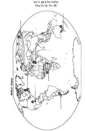
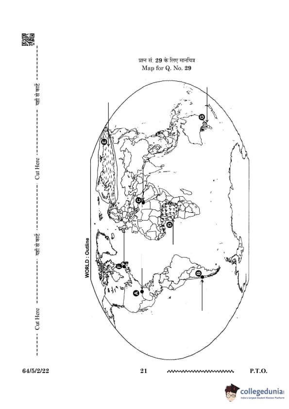
On the given political outline map of the world, seven geographical features have been shown as A, B, C, D, E, F, and G. Identify any five with the help of the following information and write their correct names on the lines drawn near them:
A. A major sea-port
B. An international airport
C. An important shipping canal
D. An area of subsistence gathering
E. An area of nomadic herding –
F. A terminal station of trans-continental railway
G. An area of extensive commercial grain farming
View Solution
Step 1: Analyze the map and information provided to identify the locations correctly.
Step 2: Write the names of the identified locations on the map next to the respective letters.
A - Port of Rotterdam, NEW ORLEANS
B - SANTIAGO
C - Suez Canal, Egypt
D - Tropical, Africa
E - Tundra, Mongolian Plateau,
F - Halifax
G - Downs Quick Tip: Focus on key characteristics such as economic activities, infrastructure, and geographical location when identifying features on a map.
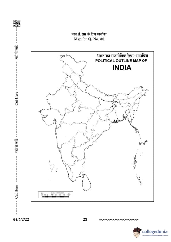
Locate and label any five of the following geographical features with appropriate symbols on the given political outline map of India:

30.1 A state leading in the production of coffee.
30.2 An oil refinery in Uttar Pradesh.
30.3 An important coal mining area in West Bengal.
30.4 A major seaport along the coast of Goa.
30.5 A state with the highest population density.
30.6 An international airport in Gujarat.
30.7 An iron-ore mining area in Chhattisgarh.
View Solution
Step 1: Analyze the map and information provided to identify the locations correctly.
Step 2: Write the names of the identified locations on the map next to the respective letters.
A - karnataka
B - Mathura
C - Raniganj
D - Mormugao Port
E - Bihar,
F - Ahmedabad
G - Bailadila Quick Tip: Focus on key characteristics such as economic activities, infrastructure, and geographical location when identifying features on a map.


Comments