


UP Board Class 12 Geography Question Paper 2025 PDF (Code 322 IP) is available for download here. The Mathematics exam was conducted on March 10, 2025 in the Morning Shift from 8:00 AM to 11:15 AM. The total marks for the theory paper are 100. Students reported the paper to be easy to moderate.
UP Board Class 12 Geography Question Paper 2025 (Code 322 IP) with Solutions
| UP Board Class Geography Question Paper with Answer Key | Check Solutions |

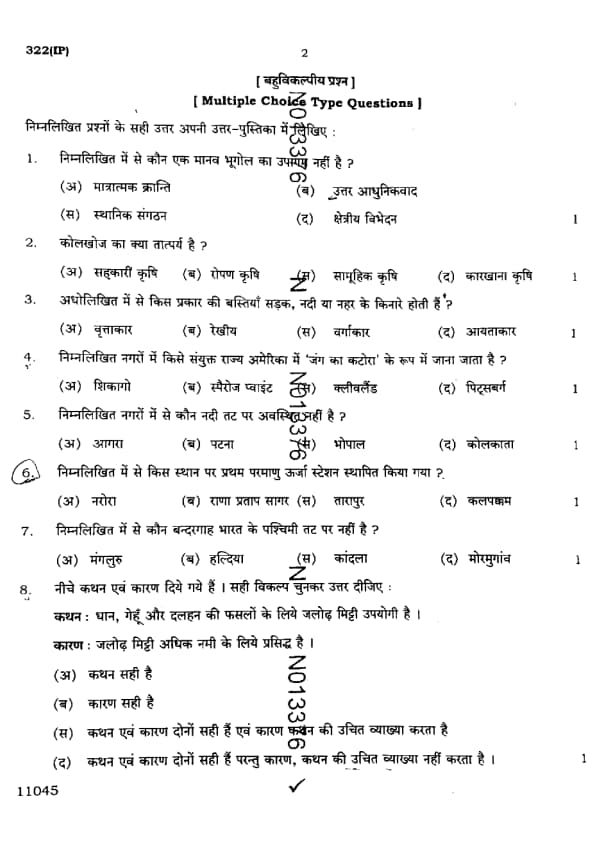
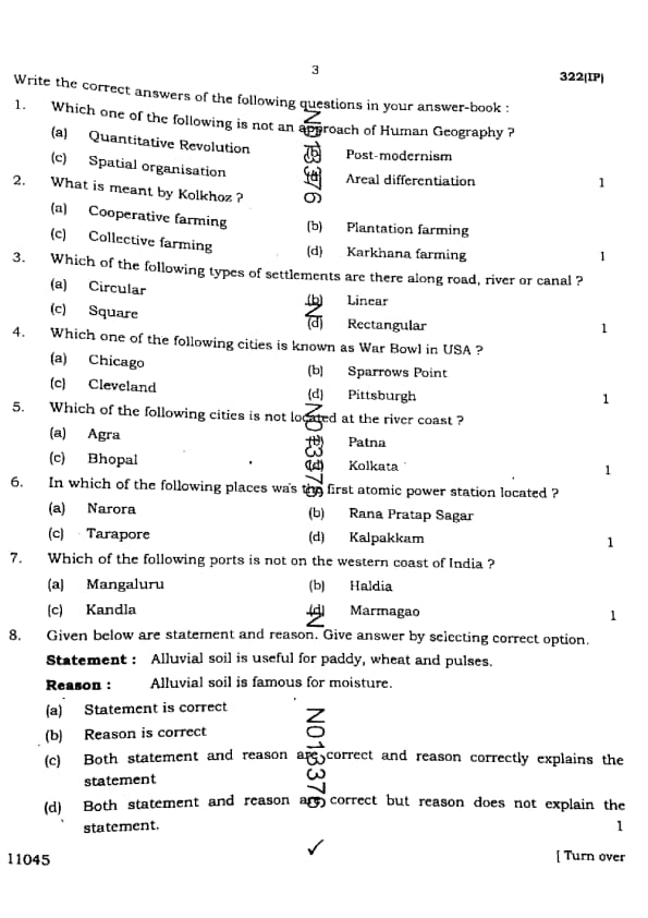
Which one of the following is not an approach of Human Geography ?
What is meant by Kolkhoz ?
Which of the following types of settlements are there along road, river or canal ?
Which one of the following cities is known as War Bowl in USA?
Which of the following cities is not located at the river coast?
In which of the following places was the first atomic power station located?
Which of the following ports is not on the western coast of India?
Given below are statement and reason. Give answer by selecting correct option.
Statement: Alluvial soil is useful for paddy, wheat, and pulses.
Reason: Alluvial soil is famous for moisture.
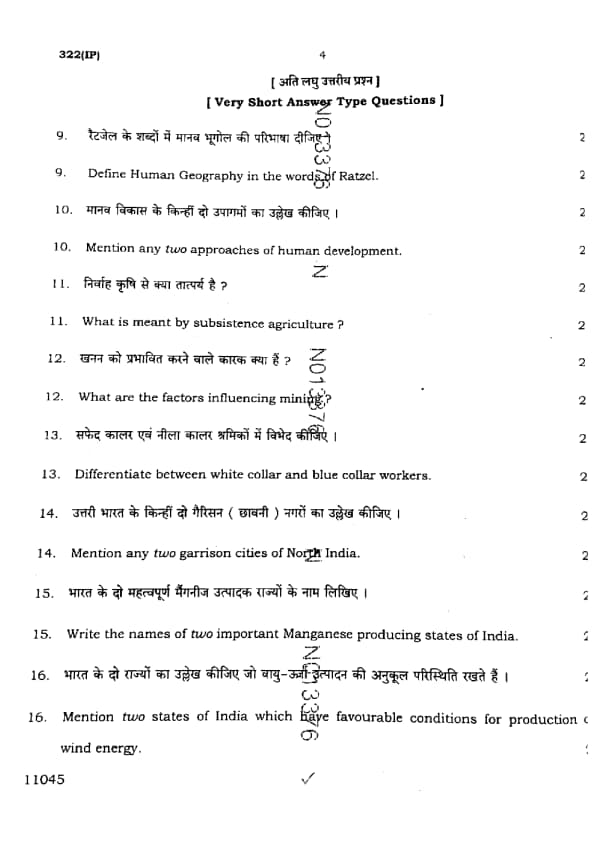
Define Human Geography in the words of Ratzel.
Mention any two approaches of human development.
What is meant by subsistence agriculture?
What are the factors influencing mining?
Differentiate between white collar and blue collar workers.
Mention any two garrison cities of North India.
Write the names of two important Manganese producing states of India.
Mention two states of India which have favourable conditions for production of wind energy.
Write a note on plantation farming.
Give a brief account of industries based on the raw material.
Explain the quaternary activities.
Write a note on Common Property Resources.
Present a brief note on cotton cultivation in India.
Mention the major industrial regions of India.
Discuss the problems of rural settlements.
Explain the contributions of Panama and Suez canals in the international trade.
Describe the major industrial regions of India.
Discuss the measures of sustainable development with special reference to Indira Gandhi Canal Command Area.
Show the following by suitable symbols in the given outline map of India and write their names also:
(i) State having the highest density of population in India.
(ii) Capital city of Kerala.
(iii) Nilgiri Mountains.
(iv) Paradwip Port.
(v) Pushkar lake.
Show the following by suitable symbols in the given outline map of the world and write their names also:
(i) The capital city of Argentina.
(ii) Lake Tanganyika.
(iii) The Great Dividing Range.
(iv) The Aral Sea.
(v) The Mississippi River.


Comments